
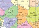

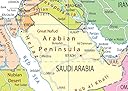
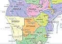

Africa Political Map - Size A1-59.4 x 84.1 cm - Paper Laminated
Details
- ColourPastel shades
- BrandTiger Moon The
- Map typePolitical
- Paper finishCoated
- Sheet sizeA1
Desertcart purchases this item on your behalf and handles shipping, customs, and support to Greece.
Details
- ColourPastel shades
- BrandTiger Moon The
- Map typePolitical
Description
🌍 Own the map that connects you to Africa’s vibrant political landscape!
- GENEROUS A 1 DIMENSIONS - Large 59.4 x 84.1 cm size ensures every detail is visible and impactful.
- VERSATILE DISPLAY READY - Ideal for home, office, classroom, or study desk to inspire curiosity and global awareness.
- VIBRANT INFORMATIVE DESIGN - Bright colors and easy-to-read text make geography come alive.
- DURABLE GLOSS LAMINATE FINISH - Protects against wear and tear, perfect for high-traffic spaces.
- COMPREHENSIVE POLITICAL DETAILS - Includes capitals, major cities, rivers, roadways, and national boundaries for in-depth learning.
This A1-sized Political Map of Africa (59.4 x 84.1 cm) features bright, easy-to-read colors and detailed political boundaries including capitals, major cities, rivers, and roadways. Printed on premium paper with a protective gloss laminate, it’s designed for durability and visual impact—perfect for educational, professional, or decorative use.
Specifications
| Asin | B00ET4Z3PK |
| Best Sellers Rank | 1,146 in Educational Charts & Posters |
| Dimensions | 59.4 x 84.1 x 0.03 cm |
| Item Weight | 100 g |
| Publisher | Tiger Moon |
Reviews
User
African States writ large
This map is large enough for me to clearly see the different countries in Africa and to equate their relevant size in relation to each other - am very pleased with it - it has been a surprise to me in regard to where the different states are situated - well worth the buy
User
Great Map
Ideal product to teach school children about Africa and how it was divided by the early explorers
User
Excellent
Presentation
User
Décorative
Belle carte manque de détail !
Common Questions
Trustpilot