Desertcart purchases this item on your behalf and handles shipping, customs, and support to Greece.
๐ Explore boldly, stay connected effortlessly.
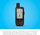
The Garmin GPSMAP 67i is a rugged handheld GPS device featuring a 3-inch sunlight-readable color display, global Iridium satellite two-way messaging and SOS capabilities, preloaded TopoActive maps, and multi-band GNSS support. With up to 425 hours of battery life in expedition mode and smartphone integration for weather and geocaching, itโs engineered for serious outdoor adventurers who demand reliable navigation and emergency connectivity anywhere on the planet.


| ASIN | B0BT3KKYYP |
| Additional Features | Bluetooth |
| Battery Average Life | 165 hours |
| Best Sellers Rank | #48,792 in Electronics ( See Top 100 in Electronics ) #40 in Handheld GPS Units |
| Brand | Garmin |
| Built-In Media | GPSMAP 67 or GPSMAP 67i handheld device, type-A to type-C USB cable, carabiner clip, documentation |
| Compatible Devices | Android, iPhone |
| Compatible with Vehicle Type | Car, motorcycle |
| Connectivity Technology | Bluetooth, USB |
| Control Method | App |
| Customer Reviews | 4.4 out of 5 stars 262 Reviews |
| Display Type | Transflective Color TFT |
| Human-Interface Input | Buttons |
| Item Dimensions L x W x H | 3"L x 7"W x 2"H |
| Item Type Name | Handheld GPS |
| Item Weight | 8.1 ounces |
| Manufacturer | Garmin |
| Map Types | North America |
| Memory Storage Capacity | 16 GB |
| Mfr Part Number | 010-02812-00 |
| Model Name | Garmin GPSMAP 67 series |
| Model Number | 010-02812-00 |
| Model Year | 2023 |
| Mounting Type | Wrist Mount |
| Number of Items | 1 |
| Screen Size | 3 inches |
| Special Feature | Bluetooth |
| Sport Type | Camping & Hiking, Outdoor Lifestyle |
| Supported Satellite Navigation System | GPS, Galileo |
| Touch Screen Type | Capacitive |
| UPC | 753759308636 |
| Unit Count | 1 Count |
| Vehicle Service Type | Car, motorcycle |
| Warranty Description | 1 year limited warranty |
I**B
Best hiking GPS created.
First - This thing is fantastic. I've not needed to use the inreach feature yet but I used to carry a 66ST and an inreach mini. Having the 2 combined is fantastic. Map abilities are amazing. Screen resolution is very good. Not as high as an iPhone but it's very purpose built so it's great for navigation and assessment. GPS accuracy is remarkable with the multi-band GPS. Most of the time, you only need GPS. Battery life is unbelievable. I've always had the 8-15 hours on 2 AA or rechargeable. To have a battery that lasts 4-5 days makes it so even if you forget to turn it off, you will rarely be in situations where it renders you inoperable. Also, you don't need to carry extra batteries or charger unless you are on a longer adventure. The "down" side (not really). The interface is so feature-packed that it does have a learning curve. Once you have it, it is cake to use. It works wonderfully with Garmin Explore. You can download your favorite track from Alltrails or other sites and import them into collections. They sync via your iphone or laptop effortlessly (setting up phone connection can have some issues but is a set and forget thing). Overall, this thing is rugged beast that covers a fantastic range of functionality. TheHikingGuy indicated he doesn't need it because of his Garmin watch of which I have one. It is so much nicer to have a handheld that has a bigger screen for map reading and orientation without needing to unfold a map unless absolutely necessary. If you are a serious hiker, you are probably carrying a satellite device anyways and this thing is so worth adding a couple ounces of weight in my opinion. If you are thinking about it and have the budget - Go for it!
J**E
Very Good Satellite GPS Unit
There is nothing like a Garmin. Bought this to use in the Upper Peninsula of Michigan when we are driving and hiking. We lose cell reception and this unit solves that issue. However, it takes quite a bit of study and trial to learn how to use it. It is not very intuitive. Has lots of features and the battery seems to last a long time.
J**T
Several times I avoided dreadful circumstances using this.
Best features are its inReach messaging and 80 hr battery life. Both in the Canadian wilderness while fishing and while ATV-ing at the Continental Divide in Colorado this was indispensable. It is quite good at seeing satellites even when packed away in a gearbag. I fished a 18,000 acre Ontario lake dotted with nondescript islands. I lost my bearings. But using TracBack I could find my way back to camp no sweat. In Colorado I was able to summon aid to help upright an ATV that had overturned in a difficult position. I'll use it again on an upcoming 18 day Cruise from Australia to Bora Bora & Singapore to keep in touch with family. I'm quite sure there are countries you can't enter with this device because it could be used for malicious purposes. I've subscribed to services that allow me to suspend service when I'm not going to be using it. (Unlimited tracking & messaging for $65/month but there are less expensive services starting around $6 monthly) While it could be used as a tracker to follow movement of your vehicle in (almost) real time it is large enough to be found by a casual observer. Still it's quite pocketable or easily carried on a belt clip or backpack strap. The screen is not a TouchPad so tapping out long messages is a bit tedious - first search for the character and then hit ENTER. The menus are not always very intuitive so you'll want to use it for a few days to be able to locate its features.
P**Z
Well made for hiking.
Great product.
J**D
Know where you're going.
It's a portable GPS device. It does what it's supposed to do and makes sure that you don't go off trail/get lost. Worth it in my opinion, plus the ability to contact your family plus call for help is always a bonus. Easy to use, user friendly.
G**C
Bulky and expensive, but reliable!
A bit large and heavy for backpacking, but it's rugged and the battery last for days. Compared to a smartphone, well, there is no comparison. When everyone else's fingers are too wet or frozen to operate their smartphone touchscreen, its screen has cracked, or the battery has died, you will remember why you bought a real GPS / Satellite Communicator combo. Yes, the Garmin software ecosystem is complex and confusing. So practice before you go, and you'll be alight.
D**S
Many Problems
The 67i will not connect to my windows 10 laptop. The laptop sees a USB cable has been plugged in, but it will not choose the correct driver. It says unsupported device. I first searched garmin's online support and followed the steps listed in every article. The USB still won't connect. I chatted with tech support. They talked me through the exact same things I found online. Still no joy. They said they escalated the issue to their "engineers". I have two other garmin devices that work fine with this windows laptop. The USB connection works fine on my Linux laptop though. My Linux laptop sees the 67i as a drive using MTP mode. However, garmin does not make any software that runs on Linux.. shame really. Without the USB connection, I'm forced to use my phone to connect to it over Bluetooth. This limits what I can do. Creating maps with custom routes is tedious. I can use the garmin connect web interface to create a route, but it too is limited. I can export GPX tracks from various sources after creating them. It seems every option requires multiple time consuming steps. Why can't garmin just make a single interface to perform route, waypoint and map creation? Now.. onto the incredibly convoluted interface. Why so many apps on the device that do various things? Seriously, I uploaded two routes to the device. One shows up under one app.. and another shows up under another app. The routes were created the same way, but one was imported via a local file on my phone. And one was imported via the garmin connect web interface. Why can't I get to them the same way on the device? I've resorted to just randomly opening apps on the device trying to figure how to get the feature I'm looking for. This is a fairly pricey device. It feels like it was cobbled together by about 100 different people who could not agree on how to get the job done. The user interface is horrible and slow. However, for this type of device, this is our only choice. This is the best in the industry. And it's a sad thing to say. Come on garmin.. how about working on streamlining your UI instead of giving us a 100 different ways to do something. And how about an interface that doesn't feel like it belongs on a flip phone? For the price, a high dpi touch screen shouldn't be out of the question. I'd return it, but there are no other players in this game that I can find. Update Oct 7 2023. I've had this for a month. It's locked up at least 4 times. Garmin still has not been able to resolve the windows connectivity problem, and they have not yet offered to replace the unit or send another for me to try. They had me collect logs from the Express app and send those. However, windows can't see the device, so I'm not sure what the point of that was... windows has to see it before Express can see it. The altimeter graph does not update during tracking or when following a route. The only way to get the graph to update is to exit the altimeter screen and return to it. Then it updates with your progress. It should be updating at the set update interval, but does not. Update Dec 22 2023. Just last week, Garmin said they may consider replacing the device. They wanted me to record it locking up and want me to record the altimeter flaw. I discovered that the device will work with USB 3.0 and higher Windows computers. It will not work with USB 2.0 though. There are a few other nitpicks I have discovered. When choosing a course to navigate, the device does not offer to navigate to the start of the course for you. I have a Garmin Edge Cycle computer, and it offers to navigate to the start of a pre-planned course. On the 67i, you have to manually scroll around the map to find the start of the course.
D**.
Great Addition to Our Camping Gear
My family loves to camp and hike. As we have begun doing some longer trails, and, in particular trails that are less traveled, it was important to us to be able to call for help, if needed, and to better understand where we were. There is a bit of a learning curve, but there are tons of YouTube videos that make learning this unit manageable. It is easy to add waypoints, track hikes, and send messages. It also provides peace of mind in case of emergency (btw, a subscription is needed for some of the features). We are very happy with our Garmin 67i and would recommend it to anyone looking for a portable and highly functional GPS unit.
P**X
Un super outil
Je ne mโen passerais plus en forรชt. Fonctionne trรจs bien. Je lโai jumelรฉ ร mon tรฉlรฉphone pour lโenvoi de messages. La carte qui vient avec est de piรจtre qualitรฉ. Jโai achetรฉ une autre carte afin dโavoir plus de dรฉtails.
O**S
Excelente compra
Lo recomiendo ampliamente
T**H
Great product
Fantastic showed up fast in mint shape works great
N**W
Great. A bit heavy
A bit heavy, but thatโs the trade off for fully, integrated, and standalone functionality.
S**N
Regretable purchase
This thing has been a complete let down. I have used garmins for over 20 years, starting with the the etrex and various other models up until purchasing the 67i recently. The 67i is by far the worst in my experience for navigation. I work in the forest industry and rely on gps navigation daily to get me to specific points all over BC and never had much of a problem finding my target locations in the past. The past 2 weeks using this new unit have cost me a bunch of extra time and hiking around the bush trying to find the target locations. I have been right at my target point with the 67i telling me I am anywhere from 20 meters to 130 meters! away from the point I am standing at. For reference, the point has previously been collected and post processed with a Trimble sub-meter GPS unit - I KNOW I am at the coordinates I am targeting. I tried resetting the unti multiple time with no luck. I have found a somewhat fix of rebooting the unit a couple times when hiking when I start getting within 200 meters of my target. Upon reboot, there is a short period (5-10 minutes) of when I can actually trust the unit. I have been hiking in and get to 225m from my target, do a reboot, then it reads I am 135m from my target. Totally unacceptable! I will be going back to my explorer+, even though I "upgraded" to the 67i so I could actually see the exact meters I am away from my target when outside of 100m - the explorer+ only shows the the nearest 0.1km unless inside 100m. Also, I do have the 67i on dual band - not gps only. It can be pretty hard to find my points and multiple times I had to used my iPhone and a gps app to navigate to my target because I couldn't trust the 67i. And the 30m drift with this thing is real as well. Pics with a few of the results I had. So disappointed.
Trustpilot
2 months ago
1 day ago